


Geography pertains to land location and features. North Dakota is positioned in the center of the continent of North America. The state covers 70,704 square miles. It is made up of three major natural regions of land. They are the Red River Valley, the Drift Prairie, and the Missouri Plateau.
The three regions of North Dakota are almost like three sloping stair steps as they go up in elevation (land height) from east to west. The fertility of the soil of each region is different. Soil fertility is a major factor in determining the type of agricultural activities that are carried out in each region.
The Red River Valley• Lowest region in North Dakota
• Once the lakebed of ancient Lake Agassiz
• Some of the richest soil and best farmland in the world
• Nicknamed “The Breadbasket of the World” is the floor of the ancient Lake Agassiz (AG-ah-see), which was formed when glaciers in Canada blocked the flow of water trying to flow north. This lake has been gone for thousands of years, but its remaining lakebed, the Red River Valley, is extremely flat.
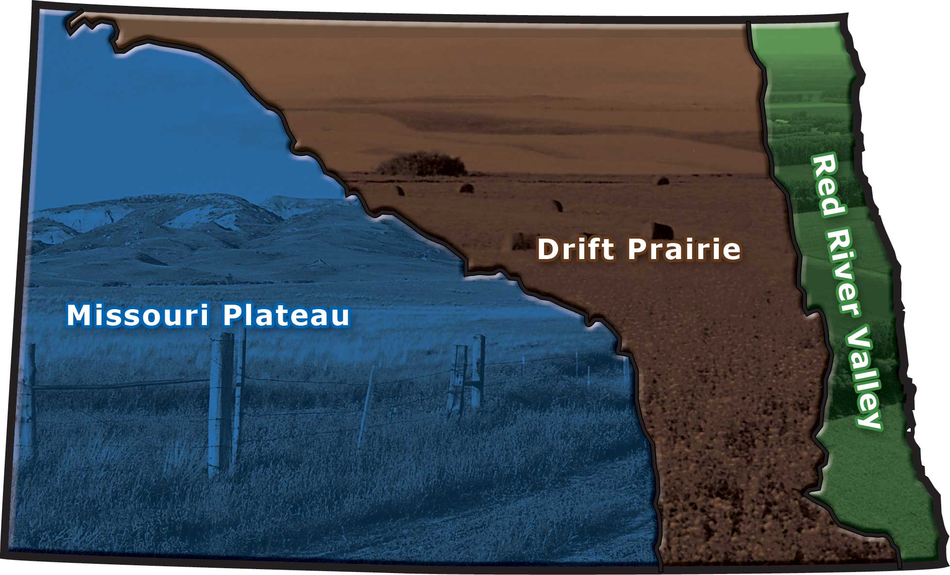
Figure 62. North Dakota has three main geographic regions. The type of agriculture varies in each of these regions. (SHSND-ND Studies)
The Red River Valley covers the eastern strip of North Dakota next to the Red River and extends into Minnesota and up into Manitoba. It is about 10 miles wide near the South Dakota border but expands to about 40 miles wide near the Canadian border. Between 750 and 950 feet above sea level, the Red River Valley is the lowest land in North Dakota.
Some of the richest soil and best farmland in the world is found in the Red River Valley. There are two reasons for this: (1) fertile soil had been brought down from Canada by the glaciers; and (2) a great deal of organicFrom living things matter had been left from Lake Agassiz.
The organic matter in the soil is called humus• Organic (from living things) matter in the soil
• Provides nutrients for plants, loosens soil, and holds moisture in the soil (HYOO-mus). Humus is important because it provides nutrients for plants, loosens the soil so that air can enter, and holds moisture in the soil. The more humus the soil contains, the more fertile it is. The Red River Valley contains a thick layer of humus.
Organic matter makes soil very rich, which means it is good for growing crops. The Red River Valley has been called the “Breadbasket of the World” because so much food is raised there. Wheat, corn, soybeans, sugarbeets, and potatoes are the main crops raised by farmers in the Red River Valley.
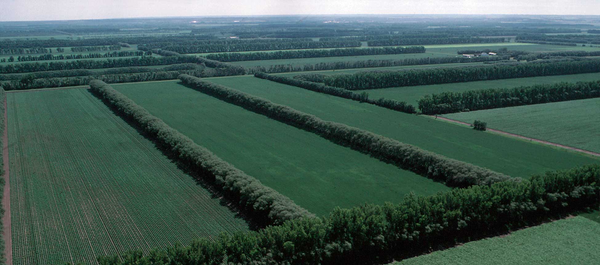
Figure 63. The Red River Valley is the eastern region of North Dakota. The Red River Valley has some of the richest soil and best farmland in the world. (USDA)
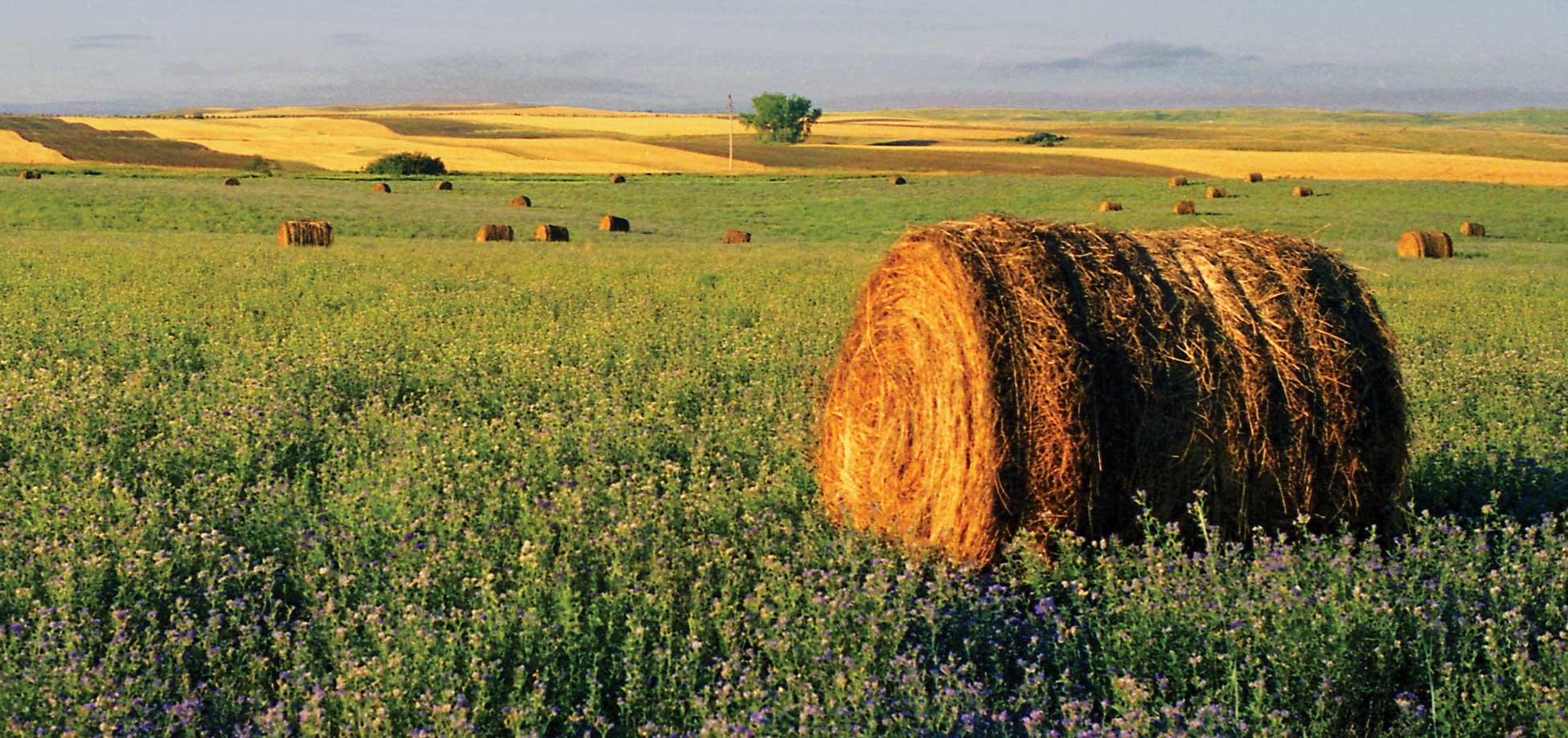
Figure 64. The Drift Prairie is the middle region of North Dakota. The Drift Prairie is the region where many small grains are grown. (David Paukert)
The Drift Prairie• Second highest land in North Dakota
• Covers most of the eastern half of North Dakota
• Has good soil from glacier deposits is the second highest land in North Dakota. “Drift” consists of the soil, rocks, and other materials that were deposited by glaciers. A “prairie” is a large, treeless region covered with grasses and wild flowers. The Drift Prairie is sometimes called the “Glaciated (GLAY-she-ate-ed) Plains.”
The Drift Prairie is several hundred feet higher than the Red River Valley and covers most of the eastern half of North Dakota. In the southern part of the state, the Drift Prairie is about 75 miles wide, but it stretches out to about 200 miles wide in the northern part of the state.
Because glaciers deposited good soil in the Drift Prairie, many farms are located in this region. Some of the main crops are wheat, barley, flax, sunflowers, canola, and soybeans.
The Missouri Plateau• Highest region in North Dakota
• West of the Drift Prairie and reaches to the Montana border (pla-TOE) lies west of the Drift Prairie and reaches to the Montana border. (A plateau is a high plain.) The eastern part of the Missouri Plateau is called the Missouri Coteau (koe-TOE). “Coteau” is a French word, meaning “little hill.” The hills are made of the soil and rocks that were deposited when the last glacier melted.
The Missouri Plateau rises to be about 300 to 400 feet higher than the Drift Prairie. At about 2,000 to 3,000 feet above sea level, the Missouri Plateau is the highest land in the state. The soil of this region is sandy and less fertile than soils farther east. Small grains and livestock production are the main agricultural activities of the Missouri Plateau.
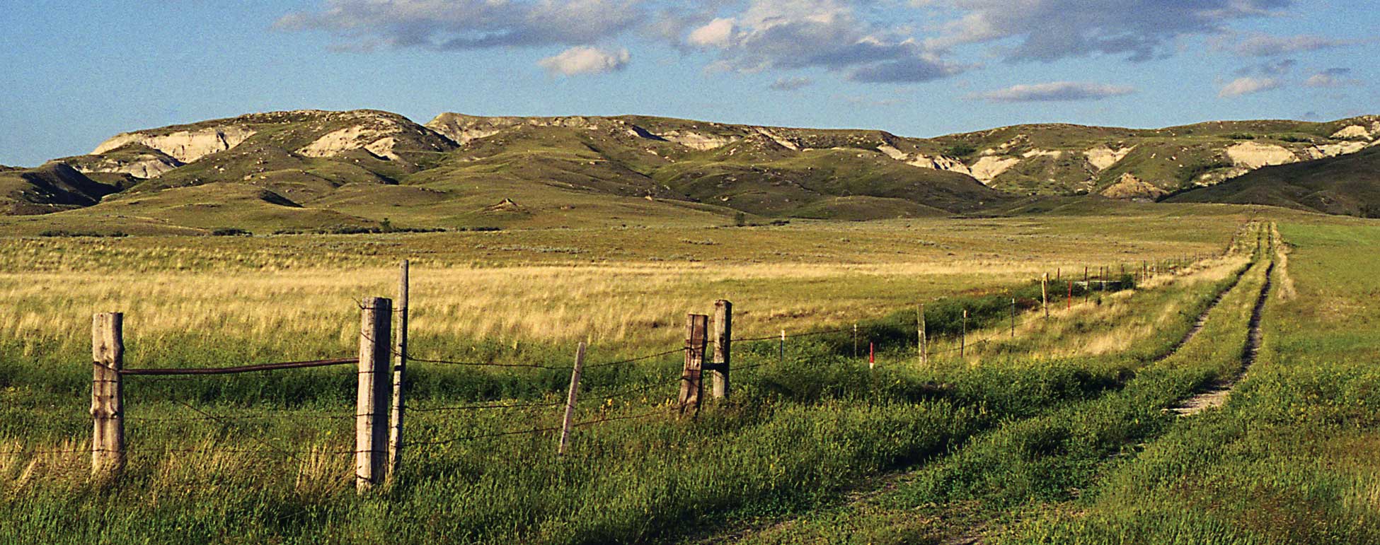
Figure 65. The Missouri Plateau is the western region of North Dakota. The Missouri Plateau region has the highest elevation and is noted for cattle ranching. (David Paukert)
One of the most unusual areas in North Dakota is the Badlands, located along the Little Missouri River in the southwestern part of the state. When the last glacier advanced into North Dakota, it did not cover this area. The features of the Badlands were created by erosion (wearing away of land) from wind and rushing water.
The Badlands are about 20 miles wide and 150 miles long. They extend from the South Dakota border to Lake Sakakawea and cover about one million acres, or about 4 percent of North Dakota. The major agricultural activity of the Badlands is cattle ranching.
Climate is the average weather that a location has over a long period of time. Because of its location in the center of the continent, far from an ocean, North Dakota has a continental climate. A continental climate is characterized by long, cold winters and short, hot summers.
The climate of North Dakota varies from east to west. Eastern North Dakota gets much more moisture than does the western part of the state. Also, the northeastern part of the state has colder temperatures than the southwest. The climate factors, along with the fertility of the soil, determine the type of agriculture that can be practiced in each region of the state.