


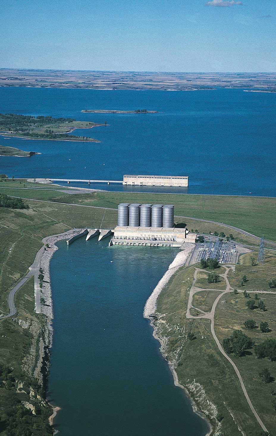
Figure 32. Garrison Dam and Lake Sakakawea. Water is released from the lake through the spillway, and it flows down the Missouri River to the south. (ND Game and Fish Department)
The Fort Berthold Reservation• Reservation of Three Affiliated Tribes (Mandan, Hidatsa, Arikara)
• Located along the Missouri River in the west-central part of the state was set up for the Three Affiliated Tribes (the Mandan, Hidatsa, and Arikara Nation) by the U.S. government in 1851. It is located along the Missouri River in the west-central part of the state.
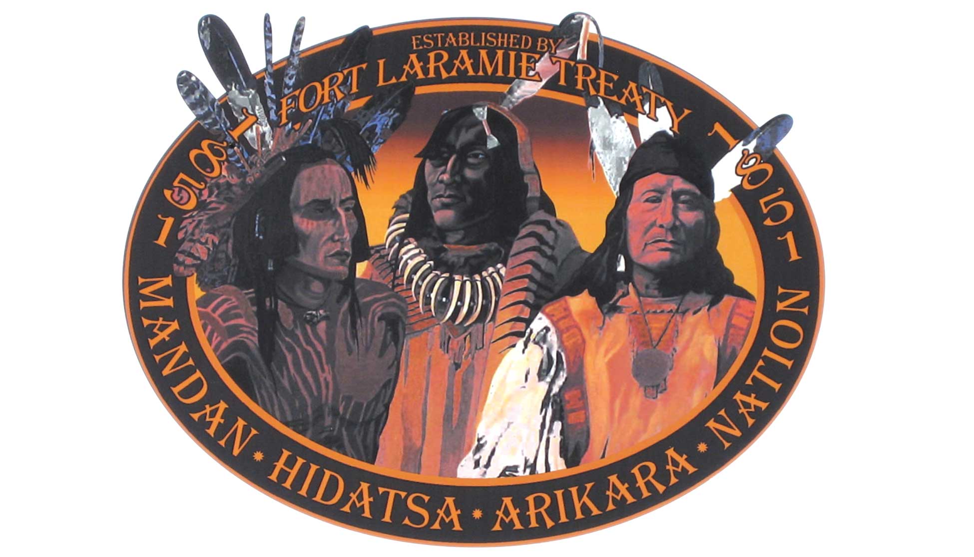
Figure 33. The Three Affiliated Tribes logo. (Neil Howe)
For hundreds of years, the Mandan and Hidatsa people had farmed and made their homes in the Missouri River bottomland. Later, the Arikara people built villages nearby. This area had very rich soil for framing, good grass for their horses, timber (trees) for building, wild fruits and so much wild game that everyone had enough to eat. Many years later the Mandan, Hidatsa and Arikara people had fruit orchardsArea of fruit trees and raised cattle on this rich land.
Each tribe had its own towns with businesses, schools, churches, hospitals, and community centers. The headquarters of the Three Affiliated Tribes was in the town of Elbowoods.
In the 1950s, something happened that forever changed the way of life for the residents of the Fort Berthold Reservation. The Garrison Dam• On the Missouri River
• Purpose—to block the flow of water to control downstream flooding
• Built in 1950s was built on the Missouri River. A damWall built across a river to hold back the water is a wall built across a river in order to hold back the water. The purpose of the Garrison Dam was to block the flow of the water so that flooding, which had been going on downstream, could be controlled.
The water that is held back by a dam forms a lake. The government had planned where this lake would be located, but there was a problem. The waters of this lake would permanently flood the best land on the Fort Berthold Reservation.
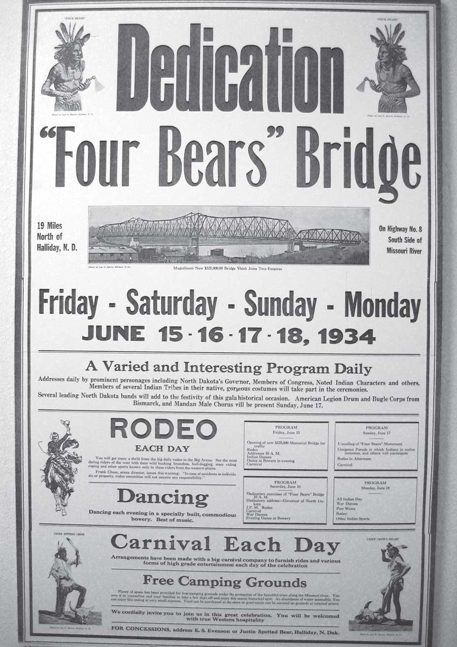
Figure 36. Dedication of the Four Bears Bridge. The Four Bears Bridge was originally built at Elbowoods in 1934. It was moved to present-day New Town, North Dakota in 1955. That bridge was replaced with a totally new bridge in 2005. (Todd Jacobson)
Members of the Three Affiliated Tribes tried to get the government to build the dam in another location so that their homes could be saved, but they did not win their case.
The people were told that they would have to move away from the land where their ancestors had lived for hundreds of years. Even though the government paid for the land they took, it was a sad time for the people.
When the gates of the Garrison Dam were closed, water began creeping over the Reservation. The flooding took many months, and by the time the lake was formed, about 155,000 acres of good farmland were permanently under water. Farms, homes, schools, a hospital, businesses, churches, parks, cemeteries, roads, and entire towns were destroyed. The last class ever to graduate from Elbowoods High School was the class of 1953, and by 1954, the school building was under 50 feet of water.
The lake created by Garrison Dam was named in honor of Sakakawea, the woman who helped guide the Lewis and Clark expedition to the Pacific coast and back. Lake Sakakawea• Lake created by Garrison Dam
• Largest body of water in North Dakota
• Third largest man-made lake in the United States
• Flooded prime land on Fort Berthold Reservation
• Water recreation area is the largest body of water in North Dakota. It is the third largest man-made lake in the United States. Lake Sakakawea is almost 200 miles long and ranges from 1 to 14 miles wide. The main part of the lake is from 70 to 175 feet deep, and the shoreline going around the lake is over 1,500 miles long. Lake Sakakawea is a prime recreation area where people enjoy fishing, camping, and water sports.
The people of the Fort Berthold Reservation adjusted to these changes as well as they could. Some of them moved off the reservation, and others moved to other places on the reservation. Several new towns were built on the reservation to replace those that had been destroyed. Mandaree and Twin Buttes were built on the west side of the lake, while White Shield was constructed on the east side. In some places, it was impossible to get from one side of the lake to the other without driving hundreds of miles.
When the towns of Elbowoods, Sanish, and Van Hook were flooded, another new town was built to take their place. This new town, located on the east side of the lake, was named “New Town.” New Town became the tribal headquarters, and many of the displaced people moved there. They built new schools, community centers, and businesses.
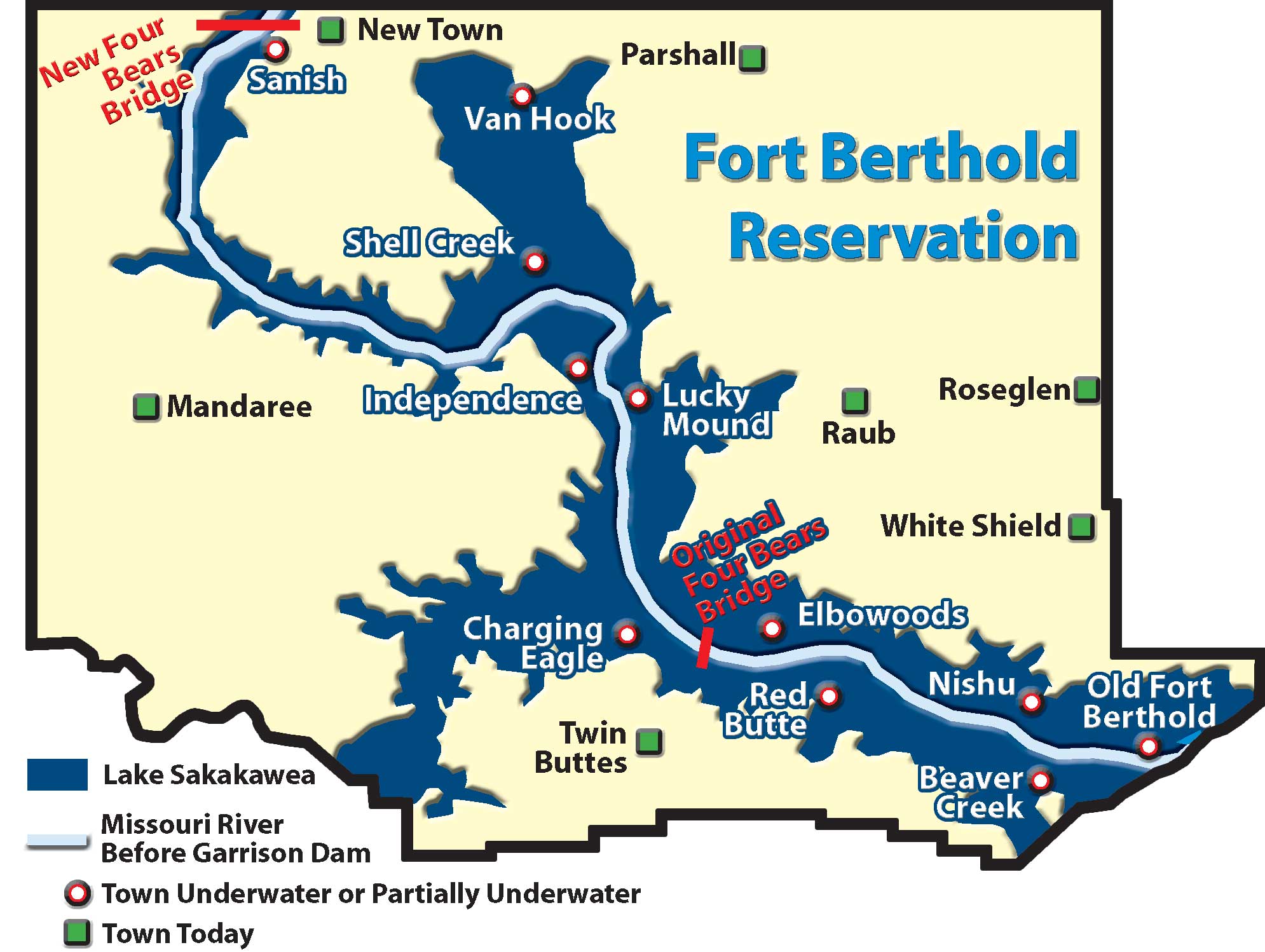
Figure 35. The Fort Berthold Reservation. This map shows the Missouri River before the Garrison Dam was built. It also shows the area taken by Lake Sakakwea after Garrison Dam was completed. Notice the towns and villages that existed before the dam was built. (SHSND-ND Studies)
In 1955, the Four Bears Bridge,• Moved from Elbowoods to New Town in 1955
• New bridge built in 2005
• Nearly one mile long
• Crosses Lake Sakakawea at New Town
• Named after a Mandan chief and a Hidatsa chief both named "Four Bears" which had spanned the Missouri River at Elbowoods, was moved to New Town. This bridge was too small for all of the traffic of the growing town, and in 2005, the largest bridge project in state history was completed. The nearly one-mile-long new Four Bears Bridge replaced the old Four Bears Bridge. It crosses Lake Sakakawea on the north side of the Reservation.
The population of New Town is now almost 2,400. Fort Berthold Community College and the Four Bears Casino and Lodge are both located there. The Four Bears Casino and Lodge is an entertainment and events center which employs around 500 people from the Three Affiliated Tribes.
Today, the Mandan, Hidatsa, and Arikara Nation (The Three Affiliated Tribes) is a strong nation that carries out its sovereign responsibilities in governing the Fort Berthold Reservation.
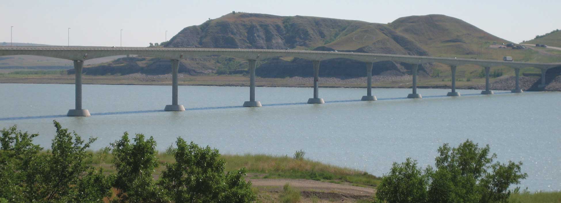
Figure 37. The new Four Bears Bridge is located at New Town, North Dakota. It was completed and dedicated in 2005. (Neil Howe)