Land
Land Base
The Standing Rock Reservation was established by the 1851 Fort Laramie Treaty, and was a part of the Great Sioux Nation. The center of the reservation was the Black Hills, the “paha sapa,” sacred to all Lakota.
The size of the reservation has been reduced through various ways. The 1868 Fort Laramie Treaty broke the Great Sioux Nation and divided the land for some of the tribes, but took the Black Hills. The series of allotment acts that began in 1868 and ended in 1915 divided the land even further, allotting to individuals and families timber allotments to provide for fuel and home-sites. Finally, nearly one million acres of western reservation lands were opened for white settlement.
Land Base
The Standing Rock Reservation is situated in southwest North Dakota on the North Dakota/South Dakota border. The reservation encompasses all of Sioux County in North Dakota, and all of Corson County and small portions of Dewey and Ziebach Counties, in South Dakota.
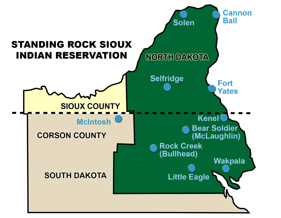
The Standing Rock Reservation covers approximately 3,625 square miles in North Dakota and South Dakota, with a total area of 2,320,275 acres. As of 1994, there are approximately 980,000 acres of land that is Indian owned, trust land. The remainder of the land is fee land of nearly 1.5 million acres, primarily non-Indian owned lands, school and township lands, and approximately 50,000 acres that was reservoir taking area as a result of the creation of the Oahe Reservoir.
| Acres | |
| Tribal Land | 294,840 |
| Allotted Lands | 542,701 |
| *State, Federal, Non-Indian Lands | 1,482,734 |
| Total Acreage within Reservation | 2,320,275 |
| *Includes approximately 50,000 acres that resulted from the creation of the Lake Oahe Reservoir. | |
Topography, Climate, Population
Topography and Climate
Most of the Standing Rock Reservation is comprised of rolling hills, eroded outcropping areas “badlands,” and vast grasslands. The soil along the Missouri and Grand Rivers varies from sandy soil along the bottomlands along the river to heavy gumbo in the higher elevations. The lands that are used for farming are irrigated with Missouri River water, or through a minimal annual rainfall of 16–17 inches. Cattle ranching and grazing is generally reserved for higher elevations. The vegetation on the prairies is comprised of short grasses, and ravines are filled with shrub trees. Cottonwood trees once lined the river bottomlands, the remnants of which can still be seen.
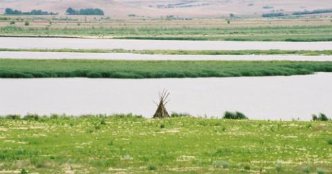
at Fort Yates during the drought of 2006. (Photo by Neil Howe)
Population
The Standing Rock Reservation has about 16,000 enrolled members. According to 2010 U.S. Census, the Standing Rock Reservation (North Dakota side only) has a population of 4,153. The lack of jobs on the reservation is one of the major reasons why tribal members leave the reservation.
| Population—Standing Rock Reservation | |
| Total Resident Population | 4,153 |
| Enrolled Members | 16,000 |
According to the 2010 U.S. Census, North Dakota counties that include Indian reservations are among the few areas of the state to experience population increases. Normally, the age distribution of a population is important when determining the labor supply in the area. Age distributions do not change significantly in the short-term unless there has been a large population change in the area. With the growth of economic activity generated by the establishment of casinos and other facilities associated with the industry, population statistics are likely to increase.
Transportation and Natural Resources
Transportation
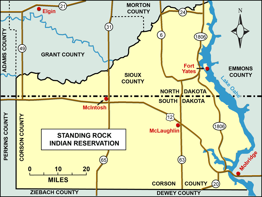
The transportation system on the Standing Rock Reservation consists of state paved highways, county and Bureau of Indian Affairs graveled or dirt roads. The reservation has access to several major highways, all of which are in good condition. North Dakota Highways 6 and 24 and South Dakota Highways 63 and 65 provide north/south transportation to the cities of Bismarck/Mandan and Mobridge/Pierre and Rapid City to the south. Highways 1804 (the historic route of Lewis and Clark) borders the east riverbank of the Missouri River going north, across from the Standing Rock Reservation. Its counterpart, Highway 1806, follows the Missouri River south through the Standing Rock Reservation, and serves as the main transportation route for the communities of Cannonball and Fort Yates. The other main Indian communities are located some distance from major transportation networks. Since there is no mass transportation system on the reservation, residents rely heavily on privately owned vehicles or secure rides where available.
Natural Resources
The Standing Rock Nation is attempting to build their national grasslands. Many of the mineral rights of the lands, currently under lease, are owned by the Standing Rock Sioux. Along the Missouri River, there are approximately 15,000 acres above the 1620 contour lands (lands that are in excess of project needs). The Tribe is seeking to have those lands returned to tribal ownership.
Many Indian ranchers/farmers have lost their lands through business failure. Within the last 20 years, 150 Indian cattle operators have gone out of business. There were only 19 Indian cattle operators in existence on the reservation in 1994. In contrast, four-hundred fifty (450) non-Indians are leasing Indian land on the Standing Rock Sioux Reservation. (White Lightning, 1994) The Farmers Home Administration (FmHA), as a matter of practice, takes those lands out of trust. The Standing Rock Dakota/Lakota are seeking, under the Indian Land Consolidation Act, to require lands under FmHA control. Through the use of cooperative agreements, they hope to assure that Indian lands remain in Indian ownership. The Standing Rock Sioux Tribe is seeking to acquire the Shadehill Dam and Reservoir.
Economy and Infrastructure
Tribal Economy
The Standing Rock Sioux Tribe’s major economic occupation is cattle ranching and farming. The Standing Rock Sioux Tribe established various industries for the Tribe on the reservation and plans to develop more enterprises.
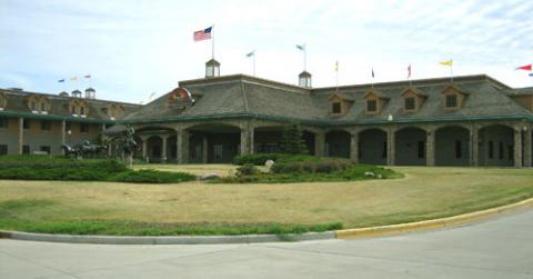
Prairie Knights Casino.
In the area of economic development the Tribe currently operates the Prairie Knights Casino and Lodge and Prairie Knights Quik Mart, Grand River Casino, Standing Rock Farms, and Standing Rock Sand and Gravel.
The district also operates businesses such as the Bear Soldier Bingo, Big Foot Bingo in Little Eagle, bingo operations in Cannon Ball, Fort Yates, and Porcupine which support their local districts. Bear Soldier has a grocery store, Cannon Ball has a convenience store/gas station, Bullhead has a trading post and Little Eagle has a laundromat. Enrolled members of Standing Rock own their own businesses: The Standing Rock Cable Vision Inc., White Buffalo Store, Missouri Drift Inn, Taco Johns, Henry’s Standard, Tim’s Conoco and Laundromats, Richie’s Ponderosa Plaza, Beauty Saloon, Pelican lounge and restaurant, Missouri Drift Inn Video, Pelican Video, and Sweat Shop Gym in Fort Yates.
There are non-Indian owned businesses throughout the reservation, primarily in McIntosh and McLaughlin, South Dakota and in Selfridge and Solen, North Dakota.
Infrastructure and Services
Montana-Dakota Utilities Company and Mor-Gran-Sou Electric Cooperative are suppliers of electricity and natural gas to the reservation. The Standing Rock Sioux Tribe will be developing its own utilities company and telephone company. The West River Telecommunications provides telephone service to the reservation. Lakota Energy, which is owned by a tribal member, supplies fuel and gas to homes in the districts. The MR & I Water Distribution System supplies water lines to the districts to bring clean water to all enrolled members. Many enrolled members in the rural districts still use well water.
The Standing Rock Housing Authority constructs and manages over 650 homes for Tribal members living on the reservation. This includes homes on scattered sites built through the HUD Mutual Help home ownership program on individual land or Tribal land leased for home sites. The other housing in the districts is low-income HUD Low Rent for individual Indian residents in reservation communities. As private housing stock is limited, some of the Standing Rock members own their own homes in the rural areas through other private financing. The Bureau of Indian Affairs and the Indian Health Service have some housing available in McLaughlin and McIntosh (South Dakota) for their employees. The Tribe plans to build a number of apartment complexes in the future.
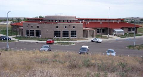
Sitting Bull College. This modern technology building is located at Sitting Bull College, Standing Rock Reservation, Fort Yates.
The need for housing is great on Standing Rock. The Tribe is looking into Habitat for Humanity homes and the government Home Grant project. The number of persons per household in the Standing Rock Service Area is 4.60 compared to 3.27 for the State of North Dakota and 3.27 for the State of South Dakota. The number of persons per family for the United States is 3.80.