


The third supporting question, “What connection to global markets does the ag sector in North Dakota have?” helps frame the concept that the ag economy of North Dakota has an impact on the global economy and vice versa. Complete the following task using the sources provided to build a context of the time period and topic being examined.
Formative Performance Task 3
Study featured sources A-C. What do these sources tell us about how the North Dakota is connected to global markets? Write a summary describing how the ag sector has impacted global markets and vice versa.
Featured Sources 3
The sources featured in this section are a combination of primary and secondary sources. Secondary sources are accounts or interpretations of historical events, people, places, and ideas by someone who does not necessarily have firsthand experience of the subject. This is the material that historians and other researchers have written about primary sources and the events, ideas, and people of history. These are the products of historical work including exhibits, websites, documentaries, performances, books, and other publications. When students read or view secondary sources, they should pay careful attention to the bibliography. What sources did the author use? Are they reliable evidence to support their claims? When students read or view secondary sources, they should also explore additional sources, including primary sources, to get an accurate understanding of the context and if the author wrote a valid, accurate, and thoughtful interpretation. What is the author’s historical argument, or thesis statement? Are their claims logical and supported by evidence? Further research of materials and sources can either prove or disprove the students’ argument.
| Source A | |
| Source B |
Isern, Thomas D. “Custom Combining in North Dakota.” North Dakota History Vol. 49.2: 4-11 (1982). |
| Source C |
North Dakota Trunk Highway Map (1924) 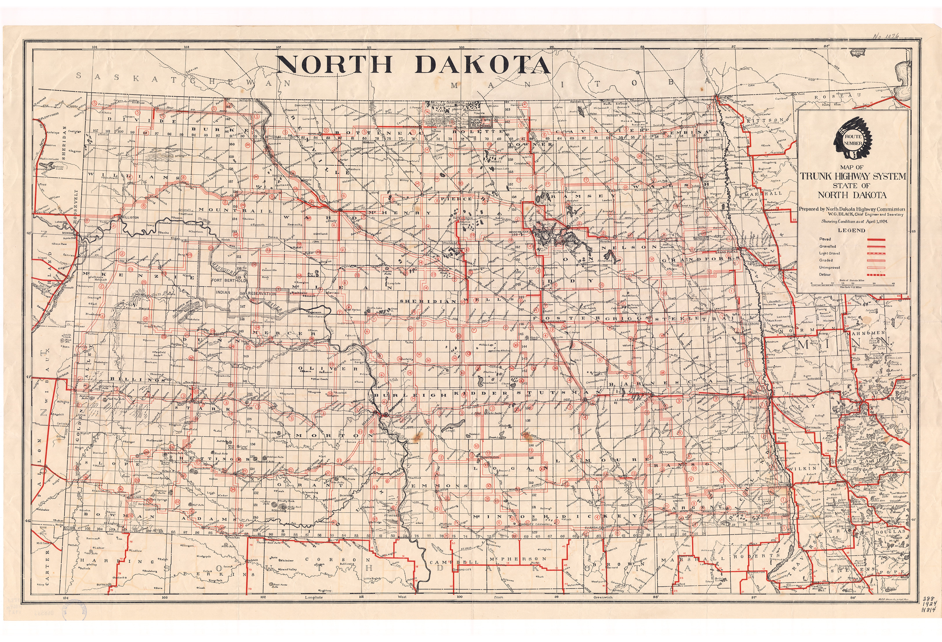
Source: SHSND 388.1 N864m 1924. This map was printed in1924 for the use of travelers in the state. It measures 38 by 24 inches. Cars were widely used by 1924, and especially popular with farm families. However, this map indicates the difficulty of traveling around the state, or even from the countryside to town, by automobile in the 1920s. Few roads were paved or graveled. Travel was slow and often impossible when muddy or snow drifted. Drivers had to be prepared to change tires often, perhaps as much as four times between farm and town when the roads were badly rutted. Read the map key carefully. How many miles of paved roads were available to drivers in 1924? Where were they located? Which of the highway numbers are still in use today? How do North Dakota roads compare to roads in western Minnesota or northern South Dakota? |