


During earth’s geological history, there have been at least 11 different periods when the climate became so cold that ice descended from the polar caps toward lands that were usually too warm for permanent ice. This process is called glaciation (glay see A shun). The last ice age began about 2.6 million years ago and caused several different periods of glaciation.
During the Pleistocene (PLY sto seen) Epoch, there were many periods of glaciation. Some glaciers were thousands of feet thick. Only about one-half of a glacier’s mass was made of ice. The other half consisted of debris picked up by the glacier. The debris included anything that was in the glacier’s path. Rocks, gravel, and sand were picked up in one place and moved to another. The rocks and sand picked up by the glaciers were later left where the ice began to melt. These deposits are called glacial till.
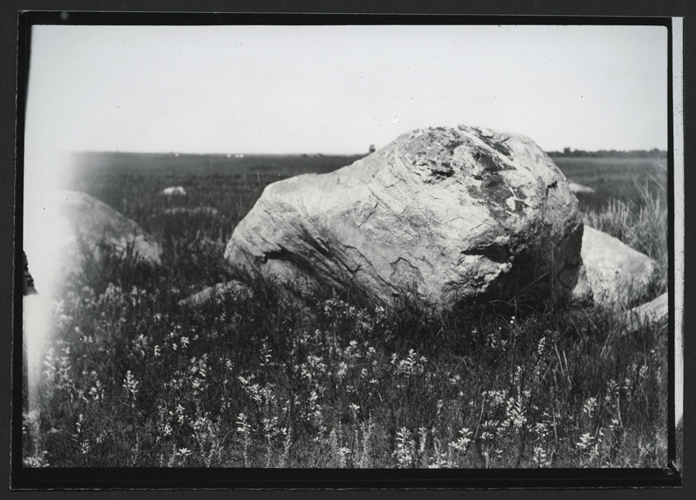
The glacial deposits took several forms. Individual rocks that remain are called erratics. The Pleistocene was also a period of erosion, so smaller rocks and sand washed away (or blew away in the wind) leaving only large boulders. These boulders are called erratics because they would not have been found in North Dakota if they had not been brought here by glaciers. Geologists study erratics to document a glacier’s path. (See Image 14.)
Glaciers also left piles of sand, gravel and rocks that formed hills. These are usually called moraines (mor RAINS). If a river of meltwater ran beneath a glacier, the sediment it carried formed a long ridge when the glacier melted. These ridges are known as eskers (ESS kers).
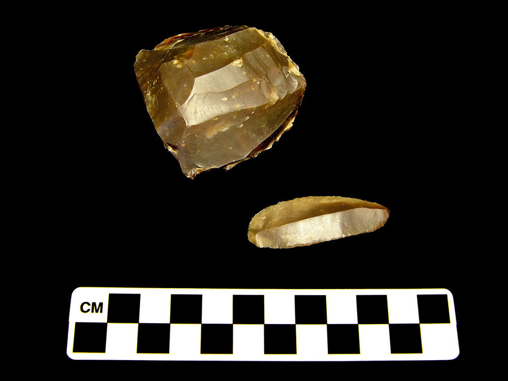
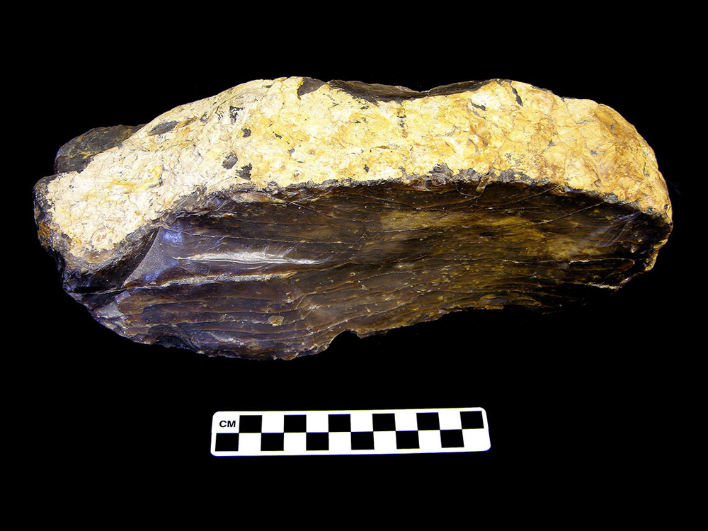
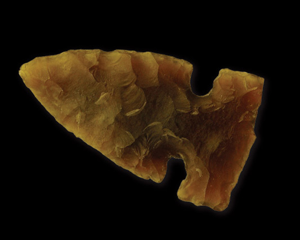
Geologists think it is possible that glaciers brought large blocks of silica-rich stone to North Dakota. The origins of this particular kind of flint have never been located, so geologists can only construct theories about its origin. This flint is known today as Knife River Flint. (See Image 15.) It has played an important part in our history. Though scientists are not sure where the flint originated, glaciers deposited flint rocks of different sizes in west central North Dakota about two million years ago. People began using this dark brown rock to make sharp points for weapons, knives, and other tools soon after they arrived around 10,000 years ago. (See Image 16.) Over the course of centuries, people traveled to the Knife River Flint quarries to mine and trade for flint. By 600 A.D., flint was being used by people as far away as Illinois and Ohio. (See Image 17.)
The last of the Ice Age glaciation events is the most important to North Dakota. This event occurred between 25,000 and 12,000 years ago. Ice sheets, perhaps 400 feet thick, covered about three-fourths of the state. The ice sheets extended as far south as the Missouri River.
As these glaciers moved, they created rolling hills on the western edge of their path. The water melting from the glaciers on the eastern side created the huge Glacial Lake Agassiz which covered 110,000 square miles North Dakota, Minnesota, and Canada. The lake was 300 feet deep at the place where Fargo now stands. As Lake Agassiz drained away (about 8,500 years ago), the sediment leveled the valley floor. The glaciers dropped sand and gravel deposits along the shores of Lake Agassiz. The sediment was 100 feet deep in places. This area became the Red River Valley. The remains of the glacial melt were channeled into a bed for the Red River of the North.
The last glaciers formed the topography that we are familiar with today. The glacier gouged and leveled the land as it moved south. Then it stopped for a while (hundreds of years) at its farthest point. Where the glacier stopped, the melting ice dropped piles of debris that formed moraines. The moraines are mostly located in a line 10 to 20 miles wide east of the Missouri River. This area is known as the Coteau du Missouri, or Hills of the Missouri. The area is dotted with lakes and potholes. These small ponds attract waterfowl and other migratory birds. Today, the area is also known as the Central Flyway.
The glacial deposits also contain the fossilized remains of the animals that lived during the Ice Age. Wooly mammoths, mastodons, giant bison, ground sloths, and horses,Many other states experienced the Ice Age. Many of the same animals that were characteristic of the late Ice Age in North Dakota can also be found in Illinois. You can read more about Ice Age animals (as presented by paleontologist Dr. Charles Collinson) at the Illinois State Geological Survey website. lived in North Dakota during the Ice Age. Most of these animals became extinct near the end of the Ice Age.Paleontologists and geologists don’t know exactly why Ice Age animals such as the mastodon became extinct. No one knows the facts about Ice Age extinction, but scientists use evidence from rocks, bones, and kill sites to support different theories.
One theory is that humans (using Clovis points attached to spears) hunted animals such as mastodons, mammoths, and horses to extinction. Humans also hunted other animals that did not become extinct, but it is possible that by killing off a critical portion of some species (keystone species), hunters weakened the environmental links that supported other species.
The second theory is that the animals did not adapt to the changing climate. As the climate changed, plants evolved and some disappeared. The theory holds that the lack of food sources may have led to extinction. Climate change could also disrupt breeding patterns causing the birth rate to drop below the death rate of mature animals.
The third theory that is currently under discussion is that extinction of Ice Age mammals was caused by hyperdisease. Hyperdisease is a highly infectious disease that passes from animal to animal. This theory proposes that humans brought diseases with them into the New World. Most humans were probably not critically affected by these diseases, but passed them on to the animal populations that had no natural defenses against the disease.
Any one of these theories may be correct. It is possible that scientists will develop another theory or that more evidence will be uncovered that will support one or possibly a combination of all of these theories.
The Ice Age ended when the climate warmed again. Humans entered North Dakota near the end of the Ice Age (as far as we know right now.) The glaciers were gone. The climate had warmed (enough for human occupation), but was still cool and moist enough to support forests of spruce and aspen trees. Bogs contained the last of the meltwater.
Why is this important? Much of our North Dakota landscape as we know it today was shaped by the ice sheets that slowly flowed into this area about 25,000 years ago. The ice moved the Missouri River and forced it to flow south. The ice created the Red River of the North and made its wide valley the most important agricultural land in North America. The ice pushed up hills and gouged out ponds. Most of the land we farm, hike, swim, fish, hunt, and drive through is a product of glaciation.
Glaciers formed the agriculturally important plains of the Red River Valley and brought Knife River Flint to the region. Today’s economy is often linked to the work of the glaciers that moved into North Dakota several times over millions of years.