


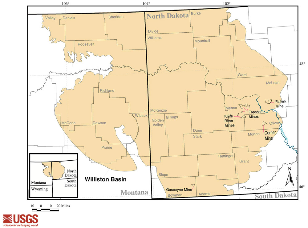
North Dakota lies on top of a large geologic feature of North America called the Williston Basin. (See Map 1.) The Basin, more than 300,000 square miles in area, includes Saskatchewan, Manitoba (both in Canada), Montana, and South Dakota. The largest portion of the Williston Basin is located in North Dakota.
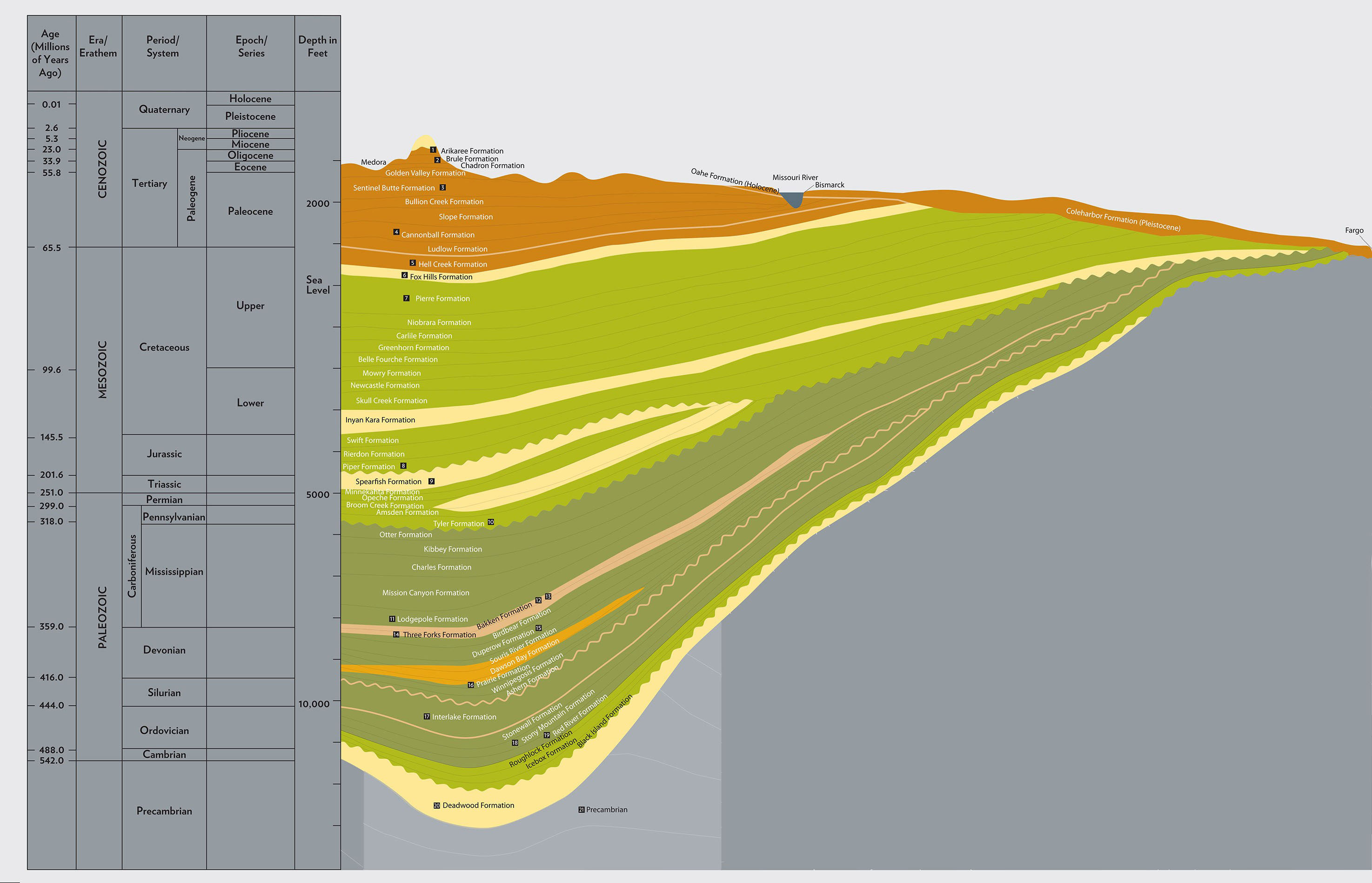
As Williston Basin formed over millions of years, layers of sedimentary rocks more than 16,000 feet deep accumulated near the center of the Basin. The center is close to the present-day town of Williston. (See Image 4) The sedimentary layers along the eastern edge of the Basin in eastern North Dakota are about 300 feet deep.
We know today that the Williston Basin is a major source of coal, oil, and natural gas. These resources are located in the Basin area because the geologic history of the region. While the Basin was forming, shallow seas covered the area, but receded several times. Animal and plant organisms lived and died in or near the seas and their remains were deposited on the bottom of the sea. Some of this organic material became oil. The woody debris along the shores of the sea became coal.
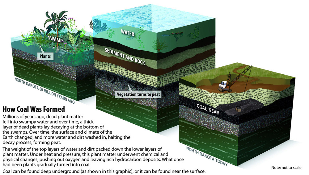
Vegetation grew in the swamps and river edges. (see Document 1) In time, dense layers of decaying vegetation in this damp environment formed a moist loose layer called peat. The plants decayed very slowly because peat forms in wetlands where periodic flooding prevents oxygen from aiding in the decay process. In time, the bogs were buried under many layers of rocky sediment. With time and pressure, the plants that had once lined the shores of the inland sea became lignite coal. (See Image 6.)
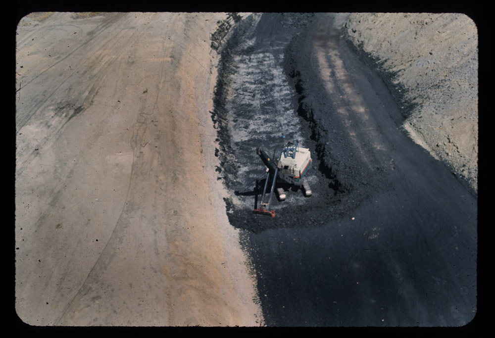
Lignite is a soft coal with high moisture content. It occurs near the surface in the east central zone of the Williston Basin. The Freedom Mine and the Knife River Mine near Beulah extract coal deposits laid down in the Fort Union formation of the Paleocene (65 to 55 million years BPE.) (See Image 7.)
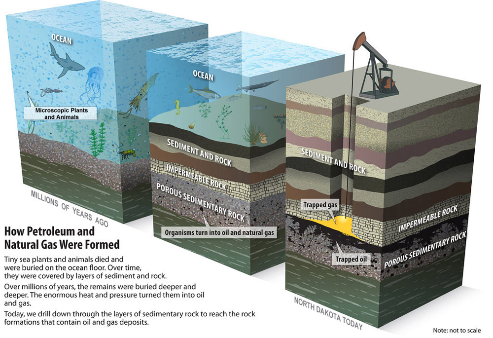
About 500 million years ago, the earth’s crust began to fold along a line in western North Dakota. Folds of this type are called anticlines. Around that time, another process began to create oil. Plankton (microscopic algae, bacteria, protozoans) floating in the inland sea, died and fell to the sea floor. Over millions of years, these one-celled organisms were covered by layers of sediments and more dead plankton. As the sediments built up, the pressure and temperature increased within the buried layers. Finally, the organisms turned into oil and gas. (See Image 8.) Oil and gas flowed through the tiny spaces in the rock. As oil and gas moved into the anticlines, they flowed upward, closer to the earth’s surface.
Anticlines trap oil in spaces that can be tapped by drilling from the surface. The Nesson anticline is the most important of these formations in North Dakota. It is located in the Williston Basin a few miles east of Williston.
Why is this important? Williston Basin geology has been responsible for a great deal of economic activity since the 19th century. While access sometimes has been difficult, the value of these mineral resources has repaid the cost of mining and drilling. The minerals found in Williston Basin formations have provided jobs and helped people heat their homes, cook their food, and pay their bills for more than 125 years.