


North Dakota covers about 71,000 square miles and has three main natural regions of land. They are the Red River Valley,• Lowest region in North Dakota
• Once the lake bed of ancient Lake Agassiz
• Some of the richest soil and best farmland in the world
• Nicknamed “The Breadbasket of the World” the Drift Prairie• Second highest region in North Dakota
• Several hundred feet higher than the Red River Valley
•Contains many small lakes, ponds, sloughs
• Glaciers deposited good soil (also called Glaciated Plains), and the Missouri Plateau• Highest region in North Dakota
• Features shaped mainly by water and wind erosion
• Not touched by Wisconsinan glacier
• Ranching is a major industry (pla-toe). These regions are almost like three sloping stair steps as they go up in elevation (height) from east to west.
The eastern part of North Dakota has the lowest elevation. The central part of the state is higher. The western part of the state is the highest. Thus, the land rises from east to west in three major steps.
The glaciers that covered most of North Dakota during the Ice Age had a part in forming all three of these regions, but each region was formed differently.
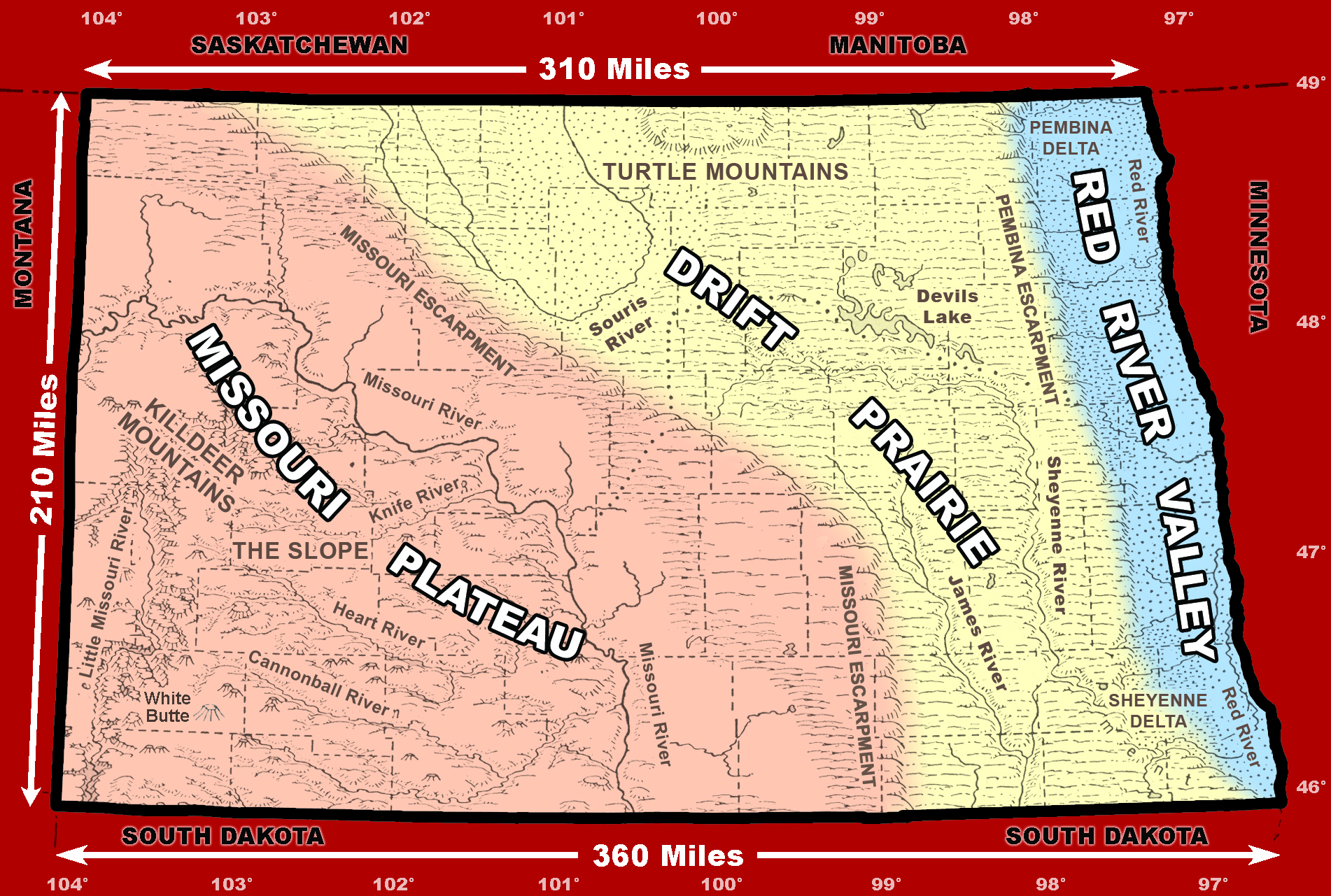
Figure 36. The three geographic regions of North Dakota are the Red River Valley, Drift Prairie, and Missouri Plateau. (SHSND-ND Studies)