Section 3: The Changing State

The Louisiana Purchase (1803) was defined as the drainage of the Missouri River and its tributaries. The eastern portion of North Dakota drains into the Red River. These two maps show how quickly territories took shape. As Michigan prepared to become a state (1837), the territory’s western portion was re-assigned to Wisconsin. The territory took on another shape when Wisconsin Territory was re-organized into the shape it would have at statehood (1848). Iowa also changed its shape a few more times before it became a state in 1846. In 1849, Minnesota Territory took on the eastern portion of North and South Dakota. Though this territory was smaller than some of the earlier sprawling territories, Minnesota gave little attention to any part west of the Red River except for the small border community of Pembina. In 1854, the western portion of North Dakota (west of the Missouri River) was given to Nebraska Territory. Nebraska Territory continued to claim the West River country until 1861. Minnesota became a state in 1858 without the area west of the Red River. The land between the Red River and the Missouri River was unorganized. It had no government and no representation in Congress. In 1861, Congress responded to the requests of the residents of Yankton and created Dakota Territory. Once again, the shape changed. Nebraska was no longer the governing body of western Dakota. Now, the tiny villages of Yankton, Sioux Falls, and Pembina were responsible for governing a huge territory that spread across modern day Montana and Wyoming. In 1863, Congress once again changed the political boundaries of Dakota Territory. The western portion was removed and turned into the territories of Wyoming and Montana (which was part of Idaho). The shape of Dakota Territory would remain just like this until statehood in 1889. In 1889, the line was drawn across the middle dividing the territory into two states, approximately equal in size. This is the state of North Dakota in 1889. The counties are somewhat different from what we see on today’s map. This is the state of North Dakota in 1916, which is the same as North Dakota today (2014). Between 1889 and 1916, several counties were changed in shape or re-named. Grant County was the last county created.


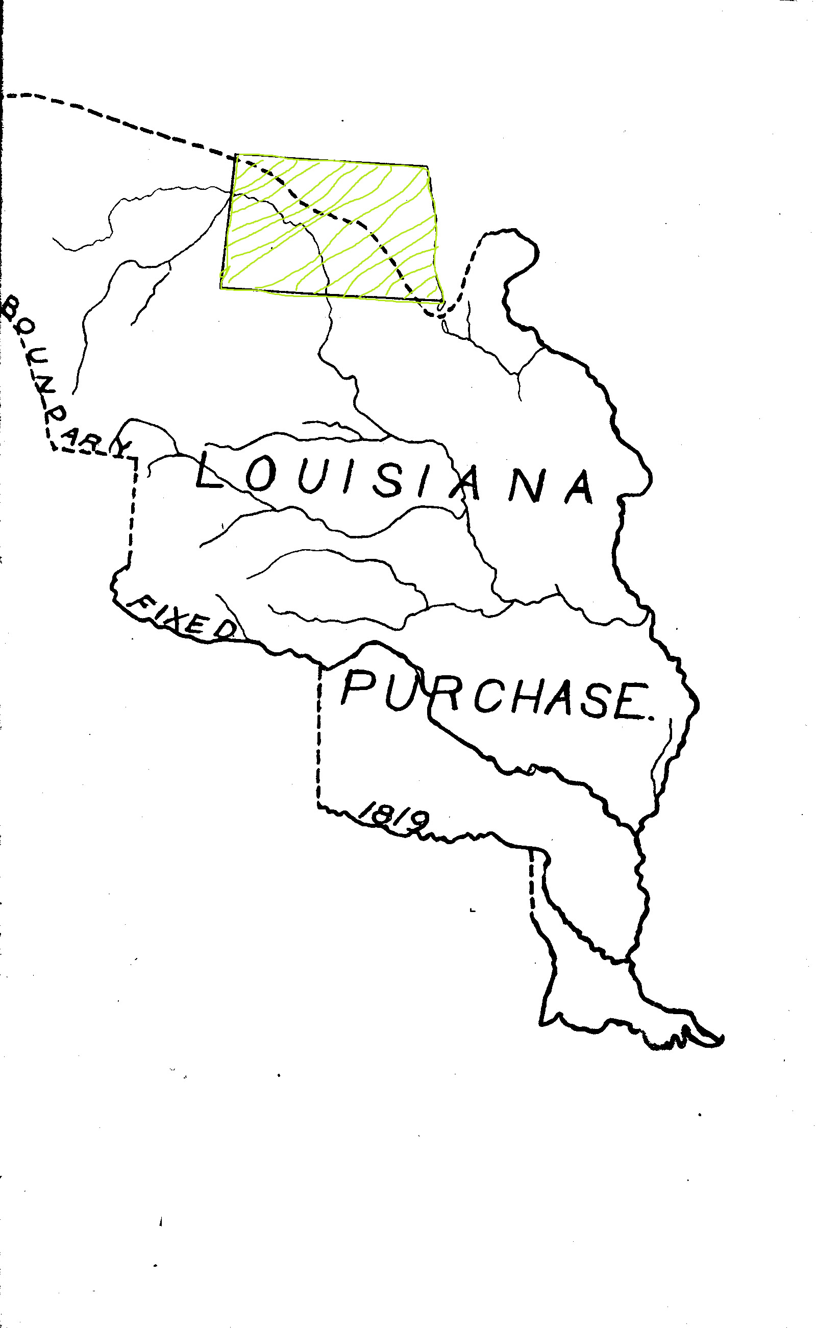
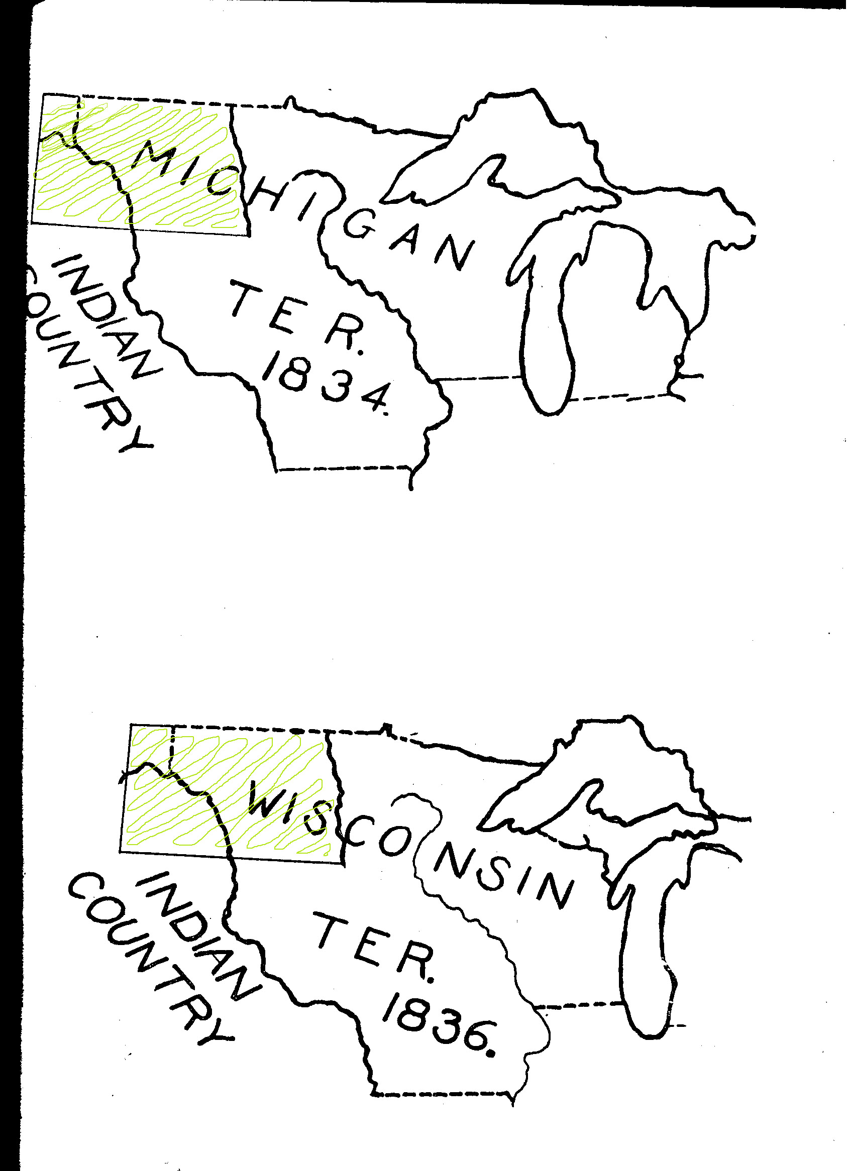
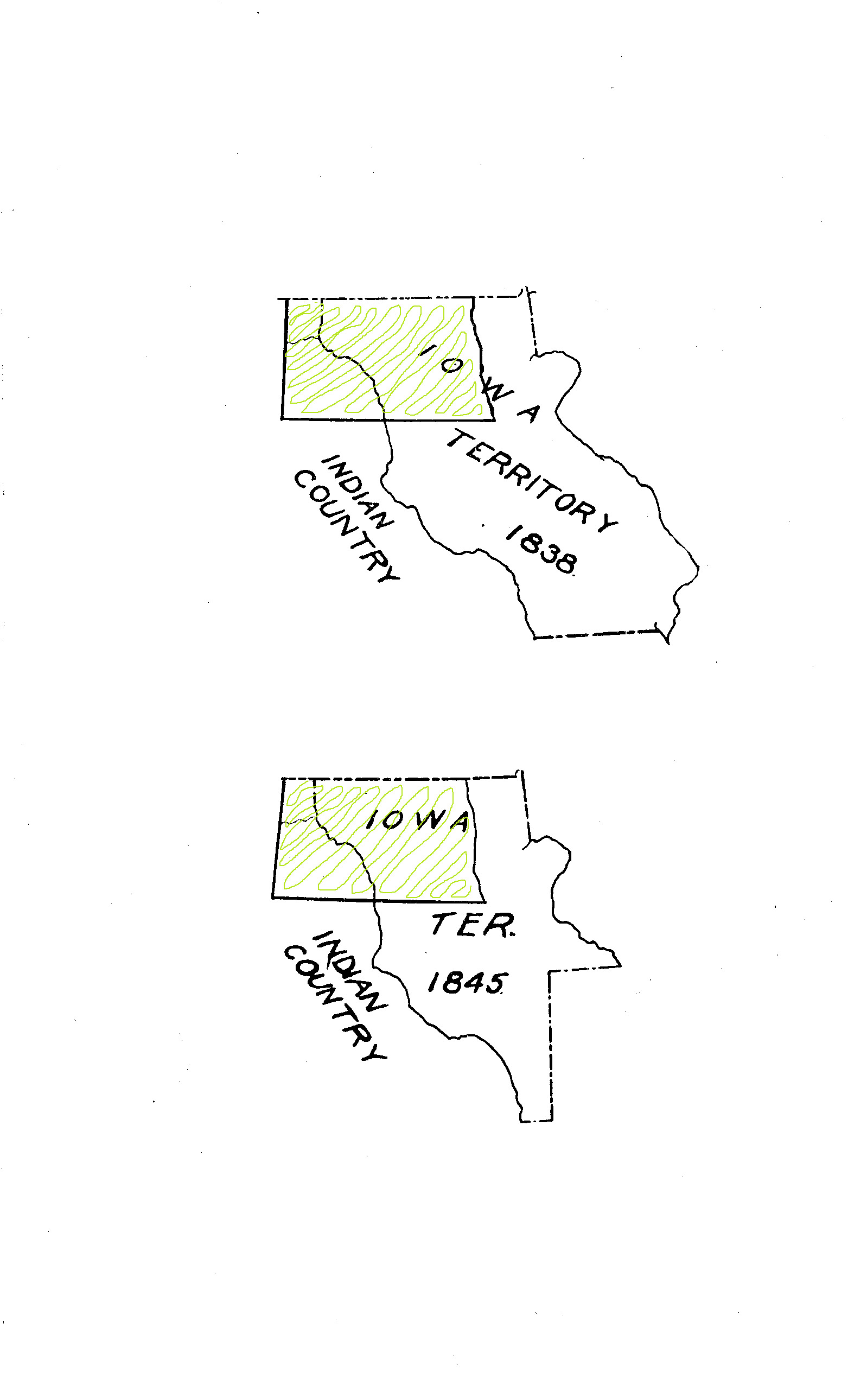
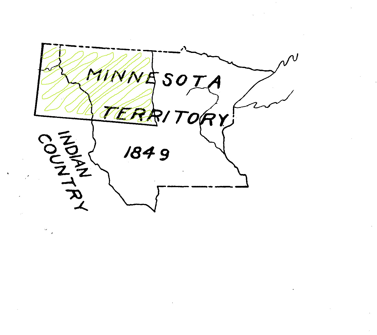
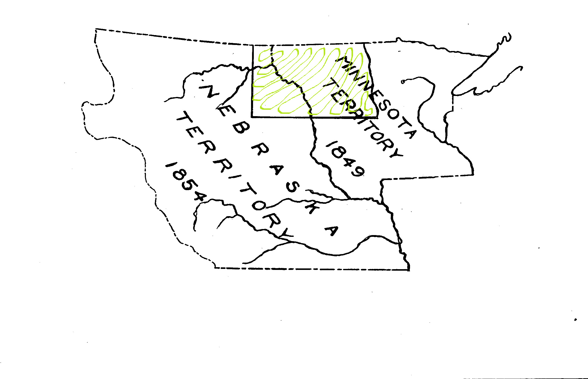
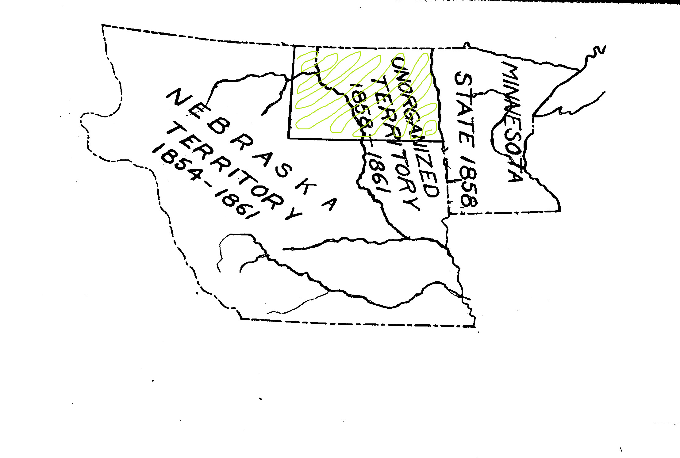
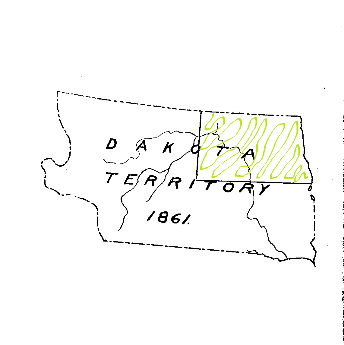
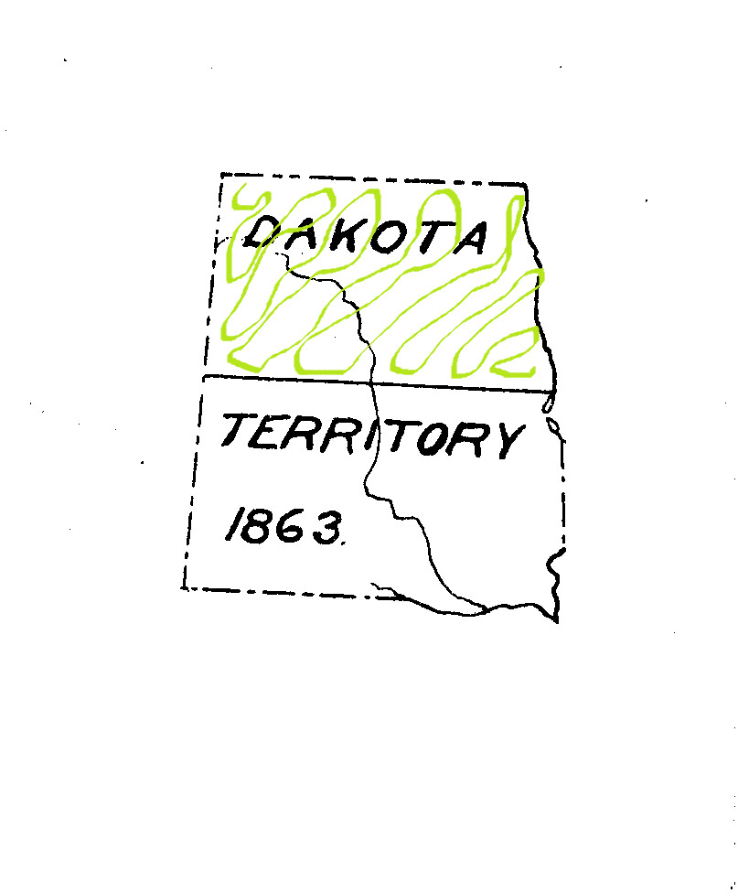
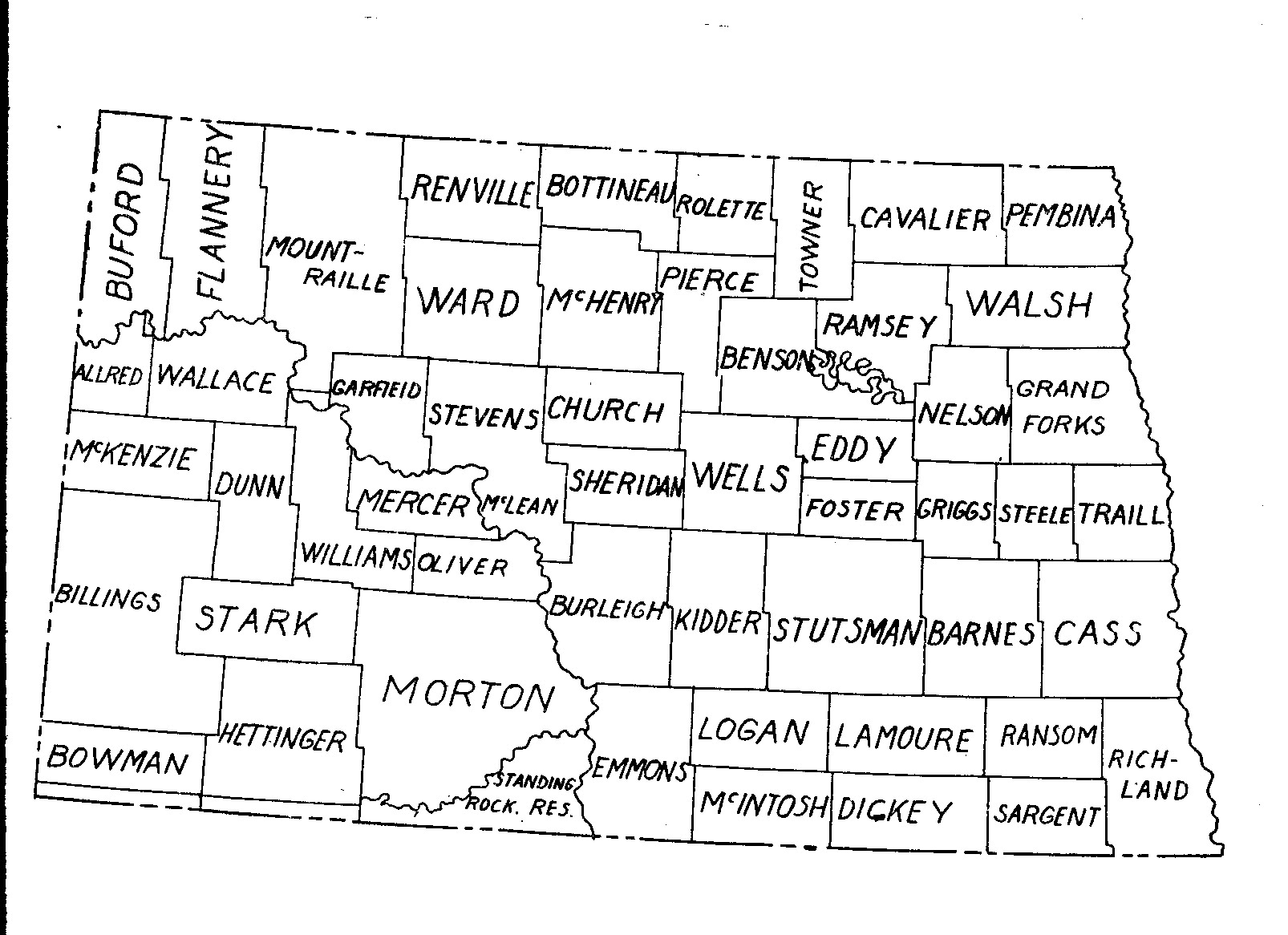
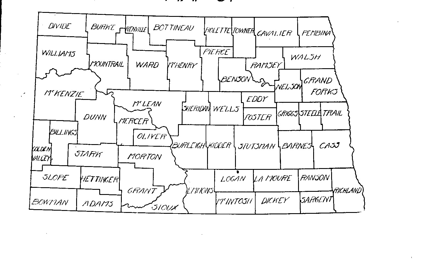
This series of maps shows how the state of North Dakota was carved from the northern Great Plains. About half of the state was included in the Louisiana Purchase (1803). The other half was part of an area that was claimed by Great Britain until 1814. From 1834 to 1861, other territories to the east and south claimed a portion of North Dakota, but few of those territories could extend their governments or services to such a remote area. Indeed, when Minnesota became a state in 1858, the western portion of Minnesota Territory (today's eastern North Dakota) was excluded, leaving the eastern portion of North Dakota without any political status at all.

As you study these maps, locate the outline of North Dakota which indicates where the state will be formed in 1889.

Source: “History of the Formation of Counties in North Dakota.”  Collections of the State Historical Society, Volume V, 1923.