


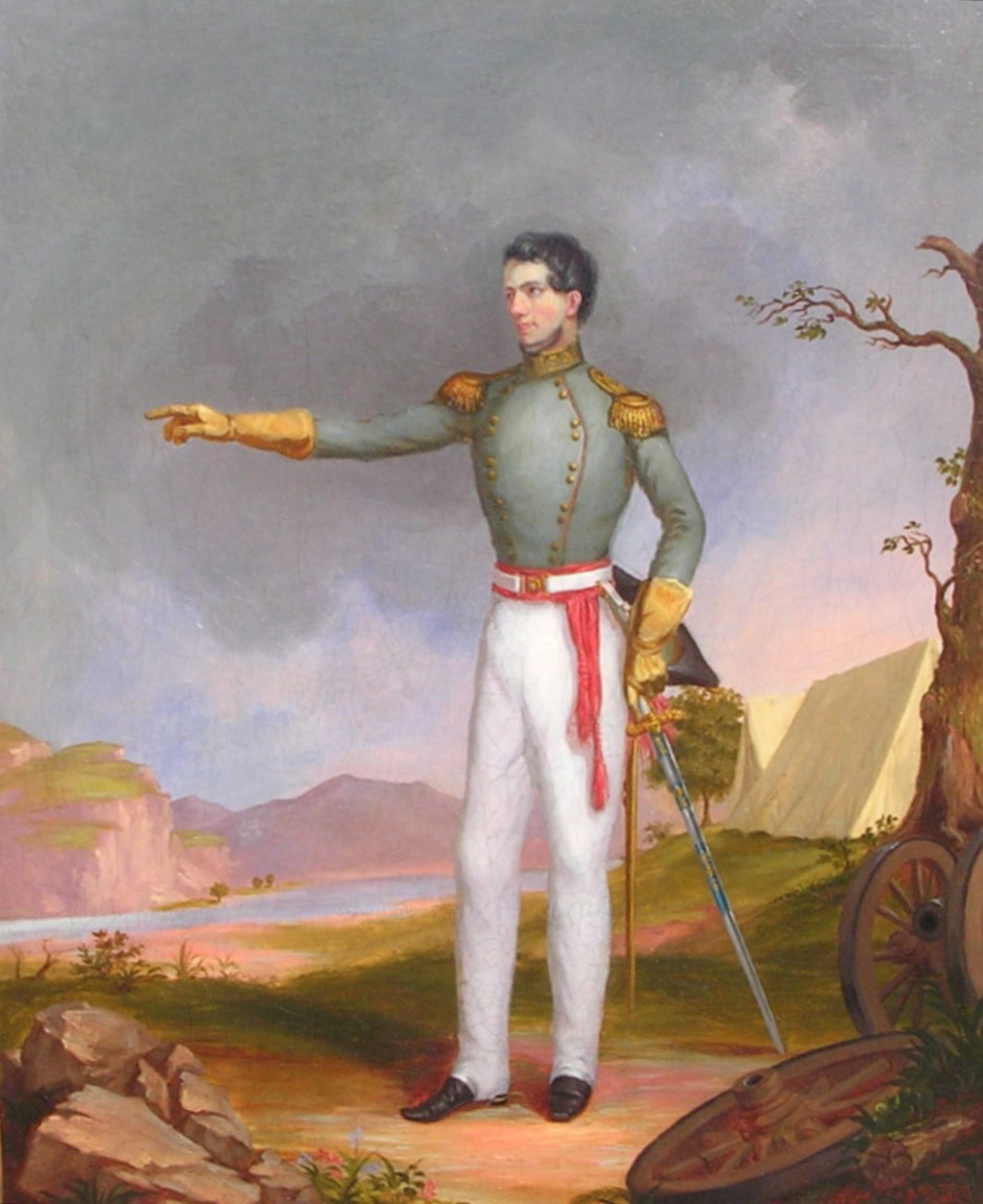
Stephen H. Long was born in New Hampshire in 1784. After he graduated from Dartmouth College, he received a commission in the U.S. Army and began teaching mathematics at West Point Military Academy. He then requested a transfer to the Corps of Topographical Engineers. Army topographical engineers were responsible for surveying, exploring, and map-making.
Long began surveying (for maps) the frontier territory of Illinois in 1816. (See Image 1.) In 1818, during a surveying trip up the Mississippi to the site of present-day St. Paul, Minnesota, he wrote a dictionary of the Ho-chunk (Winnebago) language so that he would be able communicate with the people of the region.
In 1820, Long, with a small group of assistants and soldiers, set out to explore the central Great Plains. Long’s famous report described the Great Plains as “the Great American Desert” that could not support farming. That designation slowed settlement of the Plains states and territories for many decades.
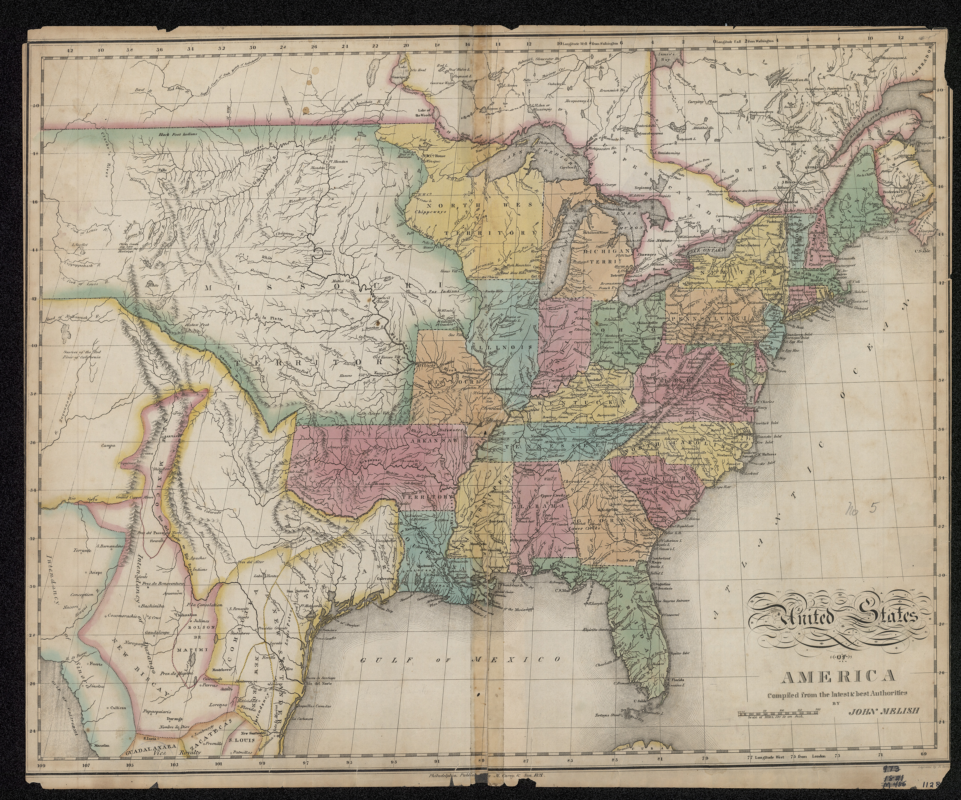
Long launched another exploratory expedition in 1823. (See Map 1.) This time, he explored up the Mississippi River and down the Red River of the North. His mission was to establish the exact location of the 49th parallel west of Lake of the Woods. He marked the boundary line near Pembina with a wooden post. The members of the expedition fired their guns in salute to the American flag, and Long declared that all the land south of the marker was part of the United States.


Long and his men were not enthusiastic about the Red River Valley. Long thought the soil was sterile and “not congenial to vegetation.” There was not sufficient rainfall for agriculture (it was a dry year). However, the men enjoyed their journey from Lake Traverse to the 49th parallel where they met friendly Dakotas, hunted bison and elk, and saw wolves and other interesting animals. They wrote of pleasant evenings (as long as bison were near, the mosquitoes were not a problem). Still, the report indicated that the region held little interest for Anglo-American settlers.
William Keating, the Red River Valley expedition geologist, wrote a report on the expedition. (See Document 1.) In the report he wrote of Long’s impressions of the Red River Valley and the things they found there. Keating also described the explorers’ disappointment in the vegetation. They were men who were more accustomed to forests. On the whole, they considered the Red River Valley an unproductive place.
Why is this important? Stephen Long was a surveyor who contributed to making maps of the upper Mississippi and lower Red rivers more accurate. He assessed the farming possibilities of the region. He concluded that the Red River Valley was not a good place to farm.